






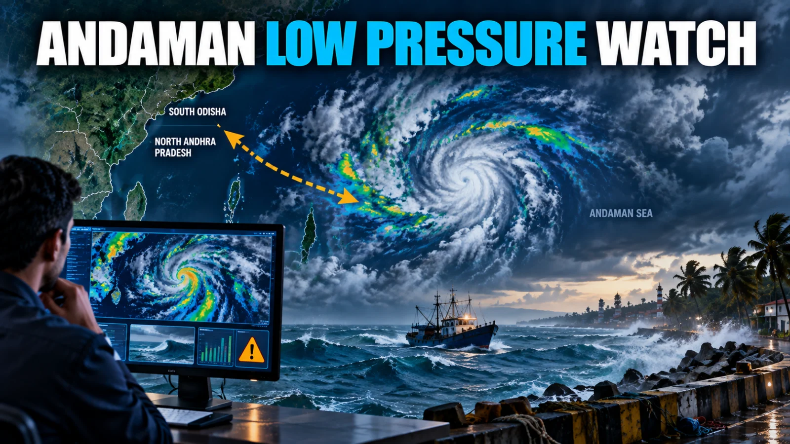
Andaman Sea low pressure September 19 is the current IMD forecast state: a low-pressure area is likely to form over the north Andaman Sea around the evening of September 19, then gradually intensify and move west-northwest toward the south Odisha–north Andhra Pradesh coasts during the following three to four days.
The most important boundary is that this is still a forecast low-pressure area. Current IMD marine guidance does not establish a cyclone, exact landfall point or storm warning. Readers should therefore follow the evolving warning state rather than treat the forecast track as a confirmed coastal impact.
Prepare for a wetter, more unsettled period around September 18–20, when IMD currently shows heavy-rain and thunderstorm or squall warnings.
Current sea-area guidance reports winds around 15–20 knots gusting to 25 knots, with slight to moderate seas that may become occasionally rough.
Current IMD/RSMC guidance advises fishermen along north and south Andhra Pradesh to be cautious while venturing into the sea.
The current warning state reviewed does not yet establish a no-venture order for Odisha. Check later marine bulletins because guidance may tighten if the system forms and intensifies.
Monitor formation, intensity, rainfall and marine warnings rather than relying on cyclone or landfall claims that IMD has not yet issued.
The highest-value next checkpoint is whether IMD confirms formation of the low-pressure area and changes its track or marine-warning state.
Andaman Sea low pressure September 19 forecast: what IMD says
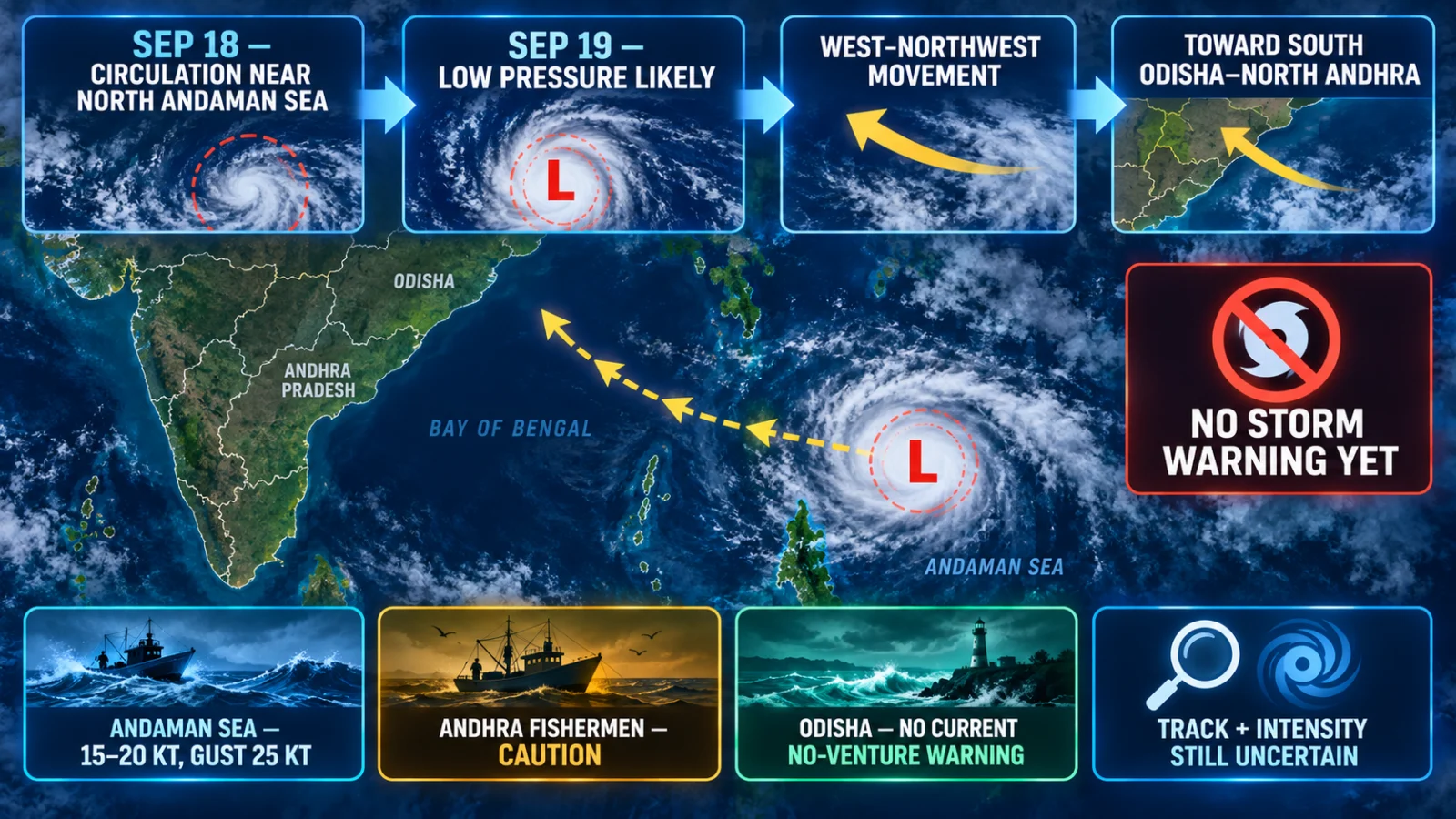
IMD’s current forecast says the precursor circulation is expected to emerge over the north Andaman Sea around the evening of September 18. A low-pressure area is then likely to form around the evening of September 19.
After formation, IMD expects the system to intensify gradually and move west-northwest toward the south Odisha–north Andhra Pradesh coasts over the following three to four days.
That wording establishes a likely formation window and broad movement corridor. It does not yet establish the maximum intensity, whether the system will become a depression or cyclonic storm, or where it might ultimately cross the coast.
Has IMD forecast a cyclone or landfall?
No current IMD evidence reviewed for this article establishes a cyclone or exact landfall. The current sea-area bulletin states NO STORM WARNING.
TPS therefore does not describe the system as a cyclone heading for Odisha or Andhra Pradesh, and does not assign a landfall date or location. Those claims would outrun the current official forecast.
Current Andaman & Nicobar Islands warning state
IMD’s current subdivision warning shows the clearest near-term weather window over the islands from September 18 through September 20, with heavy rain together with thunderstorm, lightning or squall-type conditions.
| Date | Current IMD warning state |
|---|---|
| 17 Sep | Thunderstorm, lightning or squall-type warning |
| 18 Sep | Heavy rain plus thunderstorm, lightning or squall |
| 19 Sep | Heavy rain plus thunderstorm, lightning or squall |
| 20 Sep | Heavy rain plus thunderstorm, lightning or squall |
| 21–23 Sep | Thunderstorm, lightning or squall-type warning |
For travelers, ferry users and small-craft operators, the practical point is that conditions can become difficult before the low-pressure area itself is formally declared.
What are the current Andaman Sea conditions?
The current IMD Sea Area Bulletin reports winds around 15–20 knots, gusting to 25 knots over both the north and south Andaman Sea. Rain or thundershowers are expected at many places, visibility can deteriorate in rain, and the sea is described as slight to moderate and occasionally rough.
This is meaningful marine caution, but it is not the same as a cyclone warning. The same bulletin currently says there is no storm warning.
What is the current fishermen guidance for Andhra Pradesh?
For north and south Andhra Pradesh, the current RSMC fishermen-warning surface advises fishermen to be cautious while venturing into the sea.
That wording should be preserved accurately. A caution advisory is not the same as a no-venture or return-to-coast instruction. If IMD later strengthens the warning, the article should be updated on the same URL.
Has IMD told Odisha fishermen not to venture into the sea?
Not in the current warning state reviewed for this article. The latest RSMC fishermen guidance checked does not establish a no-venture warning for north or south Odisha.
Odisha fishermen and marine operators should nevertheless monitor later bulletins closely because the forecast movement corridor points toward the south Odisha–north Andhra Pradesh coast and the warning state can change after formation.
What is the current Odisha coastal warning state?
IMD’s current Odisha subdivision warning shows heavy rain on September 18, 19 and 20.
The coastal bulletin reviewed for north and south Odisha currently reports southerly or southwesterly winds around 10–15 knots, rain or thunderstorms at a few places and smooth to slight seas. It also shows NIL port signal and no current storm-surge or tidal warning.
That means the present reader action is monitoring and preparedness, not cyclone evacuation or port-closure assumptions.
What is the current Coastal Andhra Pradesh warning state?
The current subdivision warning shows thunderstorm, lightning and strong surface winds around September 17–18, with heavy rain added on September 19 and 20. Heavy rain remains indicated on September 21 in the current warning sequence.
Because the forecast low is expected to move toward the south Odisha–north Andhra Pradesh corridor after formation, the coastal warning state should be rechecked as soon as IMD confirms the system and refines its track.
What coastal residents and travelers should watch next
The most important future IMD changes are not generic cyclone headlines. They are specific state transitions:
- confirmation that the low-pressure area has actually formed;
- any upgrade to a well-marked low, depression or stronger system;
- a material change in the west-northwest track;
- new fishermen no-venture or return-to-coast guidance;
- port warning signals;
- stronger wind or rough-sea forecasts;
- district-level heavy or very heavy rainfall warnings;
- a defined coastal crossing or landfall forecast.
What remains uncertain
The system has not yet reached its forecast formation point. Its exact intensity, final track, coastal crossing location, land interaction, later wind speeds, district rainfall distribution and future fishermen or port warnings therefore remain unresolved.
Those uncertainties are central to the current forecast, not gaps to fill with speculation. A later IMD bulletin can materially change the answer.
What happens next?
September 19 is the key evidence-backed review checkpoint because that is when IMD currently expects the low-pressure area to form over the north Andaman Sea. If formation is confirmed earlier or later, or if IMD changes the warning matrix before then, TPS should update this page immediately.
Verification method
ThePulseSignal reviewed the September 17 IMD forecast release together with current IMD coastal, sea-area, subdivision and RSMC fishermen-warning products to separate the formation forecast from already active rain and marine warnings.