




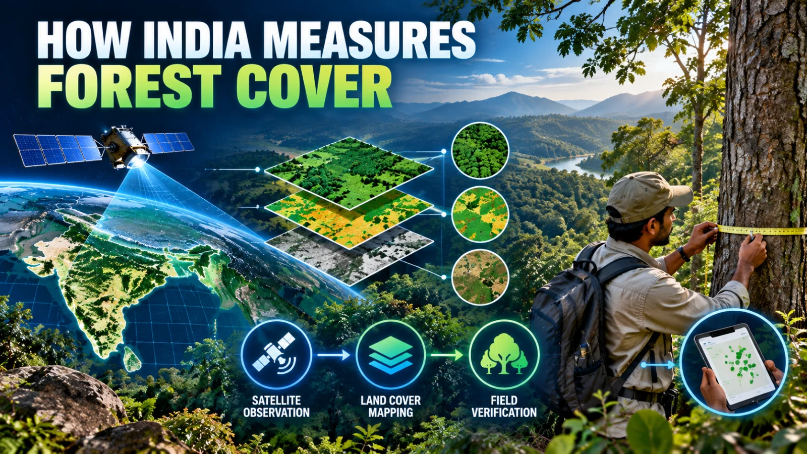
Forest cover assessment in India does not come from one satellite image or one field survey. The Forest Survey of India combines remote-sensing analysis, ground verification, forest inventory and separate methods for smaller tree resources to estimate different parts of the country’s forest and tree cover.
Direct answer: large qualifying patches of forest cover are mapped mainly through satellite remote sensing and interpreted using defined canopy criteria. Field checks and inventory data help verify and supplement that mapping. Smaller tree patches and Trees Outside Forests require separate estimation methods because they are not all represented in the main forest-cover mapping layer.
Forest cover and tree cover are not the same measurement
One of the most important distinctions in India’s forest statistics is that forest cover and tree cover are separate assessment categories. Forest cover is based on mapped canopy over qualifying land patches, while tree cover is intended to capture smaller tree resources outside those mapped forest-cover patches.
Forest cover
Forest Survey of India uses satellite imagery to map qualifying patches of land with tree canopy according to its assessment methodology. This is a biophysical canopy measurement and should not automatically be read as a legal land-status map.
Tree cover
Tree cover captures smaller patches and scattered trees that fall outside the main forest-cover mapping threshold. These resources require separate estimation rather than being counted simply by extending the satellite forest-cover layer.
Trees Outside Forests
Trees Outside Forests, often shortened to TOF, include tree resources outside recorded forest areas. Their assessment can involve sampling, inventory and geospatial methods because they occur across farms, settlements, roadsides and other non-forest landscapes.
Why satellite remote sensing is central
India is too large for a complete tree-by-tree field census to be the primary method for national forest-cover mapping. Satellite remote sensing allows the Forest Survey of India to examine large areas consistently and classify canopy-covered patches across the country.
Remote-sensing imagery is interpreted through the Forest Survey of India’s established methodology. The resulting map is not simply a photograph with green areas counted automatically. Analysts must distinguish vegetation patterns, apply classification rules and compare uncertain areas with supporting evidence.
Why the one-hectare threshold matters
The national forest-cover mapping methodology uses a minimum mapped-area threshold. This is important because smaller tree patches cannot always be represented reliably in the same national satellite-mapping layer.
That is one reason India reports tree cover separately. A small orchard, roadside tree group, urban tree patch or scattered farm trees may contribute to the country’s overall tree resources without appearing as a qualifying forest-cover polygon in the main assessment.
What ground verification adds
Satellite interpretation can show canopy patterns, but remote sensing alone cannot answer every question about what is actually present on the ground. Forest Survey of India therefore uses ground verification and field evidence to check interpretation where necessary.
Ground information is especially useful when different land-cover types look similar from space, when imagery is difficult to interpret, or when analysts need to confirm the character of a mapped area. Field evidence improves confidence in the national assessment but does not mean every mapped patch is physically inspected during every cycle.
What the National Forest Inventory measures
The National Forest Inventory serves a different but complementary purpose. Rather than simply mapping where canopy exists, inventory work collects field information about forest resources through sample plots and measurements.
This can support estimates of growing stock, tree characteristics and other resource information that cannot be derived reliably from canopy mapping alone. The distinction matters: satellite forest-cover mapping answers mainly a spatial question, while forest inventory adds physical resource measurements.
How Trees Outside Forests are assessed
Trees Outside Forests are important because a significant share of India’s trees can occur outside land that is legally recorded or mapped as forest. These may include trees on agricultural land, plantations, homesteads, roadsides, institutional land and urban or rural settlements.
Because these trees are often dispersed or occur in patches smaller than the main forest-cover mapping threshold, Forest Survey of India uses separate sampling and inventory approaches to estimate them. This prevents national tree-resource assessment from depending only on large canopy patches visible in the forest-cover map.
Where GIS, GPS and drones fit
Geographic Information Systems help organise, compare and analyse spatial forest information. GPS and DGPS can support location-specific field work and boundary or survey tasks. Forest Survey of India also identifies drone applications among technologies relevant to forest survey and assessment training.
However, the existence of a technology in training, research or a workshop should not be interpreted automatically as proof that it has replaced the established national production methodology. TPS has not verified that the September 10, 2026 workshop introduced a new mandatory nationwide drone, LiDAR or artificial-intelligence assessment system.
Forest cover is not automatically the same as recorded forest area
This distinction is essential when reading India’s forest statistics. Forest cover is a canopy-based assessment, while recorded forest area is a legal or administrative land category. The two can overlap, but they are not identical concepts.
A qualifying canopy-covered patch outside legally recorded forest land may still appear in forest-cover assessment. Conversely, land legally recorded as forest may not necessarily satisfy the canopy threshold required to be mapped as forest cover at a particular time.
What satellite forest assessment cannot prove by itself
Satellite mapping can show changes in canopy extent and density, but it does not by itself establish land ownership, legal forest status, biodiversity quality, plantation age, species composition or the ecological condition of every mapped patch.
Those questions may require legal records, field studies, ecological surveys, forest inventories or other specialised evidence. Treating every green pixel as equivalent natural forest would therefore oversimplify what the national assessment actually measures.
How to read India’s forest numbers more carefully
When an India State of Forest Report publishes a new number, first check which metric is being discussed. Forest cover, tree cover, recorded forest area and Trees Outside Forests describe different things and should not be substituted for one another.
It is also useful to distinguish a change in measured canopy from a change in legal forest protection. An increase or decrease in mapped cover does not automatically explain why the change occurred, what species are present or whether the ecological quality of the area improved or deteriorated.
What the September 10 workshop changes
A same-day MoEFCC and PIB signal identified a national workshop focused on technology for forest and tree-resource assessment. TPS has not recovered the complete controlling release or verified any resulting nationwide methodology change.
For that reason, this article relies on the established Forest Survey of India assessment framework rather than presenting the workshop as a new technology rollout. If the workshop produces a confirmed change to satellite inputs, field methods, inventory design, GIS systems, drones, LiDAR, artificial intelligence or another national assessment method, this same page should be updated to explain the new state.
Verification note
ThePulseSignal reviewed Forest Survey of India methodology material, India State of Forest Report documentation, official information on remote sensing and field inventory, and FSI material describing GIS, GPS and drone applications in forest-resource assessment. The core measurement distinctions are supported by established official methodology. The exact September 10 workshop outcome and any new production-method change remain unresolved.